The Santee Sioux of Nebraska Reservation is within Knox County located in the north central part of Nebraska. The service area includes the entire county, totaling 1,105 square miles. The community of Santee is in the north central portion of the reservation.
The Santee Sioux Tribe of Nebraska tribal headquarters are located in Santee, Nebraska.
The Santee Sioux Tribe consists of the members of the Isanti and Ihanktowan divisions of the Great Sioux Nation.
The Santee Sioux Tribe is composed of descendants of two Divisions of Dakota and Nakota people. The Ihanktowan, or Yankton and Yanktonais are called the Middle Sioux.
The Isanti or Dakota people are comprised of four bands that lived on the eastern side of the Dakota Nation. The Isanti and Ihanktowan speak the ‘D’ and ‘N’ dialect of Siouan language. Both were a river-plains people who did some farming as well as buffalo hunting.
The government identified all the Tribes with similar languages as the Sioux people.
The oral tradition of our people state that the Lakota and Dakota people were one nation. The Lakota people broke away and formed their own nation.
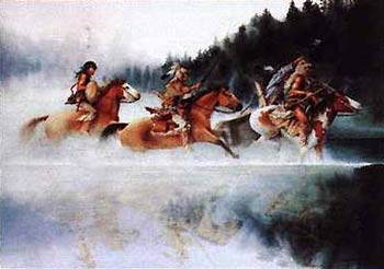
Reflections of Victory L/e
Buy This Art Print At AllPosters.com
Find out how you can use this image for FREE.
SANTEE SIOUX TRIBAL
GOVERNMENT:
The United States Government as defined by the United States Constitution has governmental relationships with International, Tribal, and State entities; therefore, Tribal nations have a government-to-government relationship with the United States. The Tribes of the Great Sioux Nation signed treaties in 1824, 1851, 1863 and 1868 with the United States which are the legal documents that established our boundaries and recognized our rights as a sovereign government.
The Santee Sioux Tribe consists of the members of the Isanti and Ihanktowan divisions of the Great Sioux Nation. The Tribe was relocated to the reservation after Little Crow’s War in Minnesota originally designated reservation lands along the Missouri River recognized in a treaty with the United States was signed in 1863. The Santee Sioux Tribe was further defined and the boundaries expanded by the Act of March 2, 1889 which identified all the reservations in present day North and South Dakota, and Nebraska.
This includes all right-of-way, waterways, watercourses and streams running through any part of the reservation and to such others lands as may hereafter be added to the reservation under the law of the United States. The original reservation was reduced to its present size by approximately 50 percent through subsequent Homestead Acts to provide land for non-Indian settlers.
The Santee Sioux Tribe operates under a constitution and is governed by a Tribal Council. The Tribal Council consists of a Chairman, Vice-Chairman, Secretary, and a Treasurer and eight additional Councilmen which are elected by the tribal members. The Tribal Council Chairman serves as the administrative head of the tribal government. The Tribal Chairman and Officers serve a one year term and are elected from within the Tribal Council. All of the Tribal Council serve a term of two years and are elected from four districts, Bazil Creek, Hobu Creek, Howe Creek, and Santee.
Prior to the inundation of lands along the Missouri River, many of the people lived on the river bottom lands. The entire community of Fort Thompson, schools and a hospital had to be completely relocated to higher ground. The infrastructure, schools and hospitals were never rebuilt as promised.
| Tribal/Agency Headquarters: | Santee, Nebraska |
| Counties: | Knox County, Nebraska |
| Number of enrolled members: | 2,500 |
| Reservation Population: | 603 |
| Labor Force: | Not available |
| Unemployment rates: | Not available |
| Languages: | Dakota and English |
LAND:
The Santee Sioux of Nebraska Reservation is within Knox County located in the north central part of Nebraska. The service area includes the entire county, totaling 1,105 square miles. The community of Santee is in the north central portion of the reservation. The Santee Sioux Tribe of Nebraska tribal headquarters are located in Santee, Nebraska.
The reservation boundary on the north includes Lewis and Clark Lake, the large reservoir formed by Gavins Point dam, one of the mainstem dams on the Missouri River. The Santee Sioux Tribe maintains the right and responsibility to provide environmental authority in compliance with Tribal and Federal law for protection of the land and resources within the exterior boundaries of the reservation through code development and regulatory mechanisms. The maintenance and protection of the land is very important to the Santee people and our future generations.
CULTURE:
The Santee Sioux are members of the Great Sioux Nation. The people of the Sioux Nation refer to themselves as Dakota or Lakota which means friend or ally. The United States government took the word Sioux from (Nadowesioux), which comes from a Chippewa (Ojibway) word which means little snake or enemy. The French traders and trappers who worked with the Chippewa (Ojibway) people shortened the word to Sioux.
The Santee Sioux Tribe is composed of descendants of two Divisions of Dakota and Nakota people. The Ihanktowan, or Yankton and Yanktonais are called the Middle Sioux. The Isanti or Dakota people are comprised of four bands that lived on the eastern side of the Dakota Nation. The Isanti and Ihanktowan speak the ‘D’ and ‘N’ dialect of Siouan language. Both were a river-plains people who did some farming as well as buffalo hunting.
The government identified all the Tribes with similar languages as the Sioux people. The oral tradition of our people state that the Lakota and Dakota people were one nation. The Lakota people broke away and formed their own nation. The Lakota/Dakota people still practice their sacred and traditional ceremonies which encompass the seven rites of Lakota Nation brought by the White Buffalo Calf Woman.
Social activities such as powwow, rodeos, and races are celebrated in the summer months. Special powwows held for individuals who accomplished a stage thier lives such as graduation or acceptance in the arm forces with traditional honoring ceremonies, give-aways, and feasts to celebrate their accomplishments. The oral tradition is still passed down from the elders to the youth.
The future of our people is in the hands of our children. The children of the Santee Sioux Tribe will bring us into the 21st century with pride and dignity.
HISTORY:
The Santee Sioux Tribe is part of the Great Sioux Nation which retains our land base in accordance with Treaties in the mid 1800’s which identified lands in eastern South Dakota and Minnesota. The Treaty of 1863 established the original land base along the Missouri River. The reservation was increased in size in the 1889 Act referred to as the Great Sioux Settlement.
At one time The Great Sioux Nation extended from the Big Horn Mountains in the west to the east side of Minnesota. Canada is the northern boundary and the Platte River in the southern boundary. The eastern land holdings of the Dakota and Nakota were subsequently reduced by Homestead Acts, other Congressional action, and the courts. The Great Sioux Nation total land ownership was further reduced in the 1868 Fort Laramie Treaty to the east side of the Missouri River and parts of North Dakota, Nebraska, Wyoming, and Montana.
This includes all of western South Dakota in the middle of the treaty lands. Crow Creek retained land on the east side of the Missouri River. The present day tribal lands are about one half of the original reservation due to Homestead Acts allowing white settlers to locate within the reservation boundaries.
The Black Hills are located in the center the Great Sioux Nation. The Black Hills are sacred to the Lakota/ Dakota people and today considered an important part of our spiritual lives. A direct violation of the 1868 Treaty was committed in 1874 by General George A. Custer and his 7th Cavalry. The 7th Cavalry entered the Black Hills, the center of the Great Sioux Nation and found gold in the Black Hills. The Gold Rush started the conflict between the United States and Great Sioux Nation. The Great Sioux Nation opposed this violation of the treaty. The United States Government wanted to buy or rent the Black Hills from the Dakota/Lakota people. The Great Sioux Nation refused to sell or rent their sacred lands.
The 7th Cavalry under General George A. Custer was requested to bring the Sioux bands in and place them on the reservation lands. On June 25, 1876, the Battle of the Little Big Horn between the 7th Cavalry and Lakota Nation with their allies Cheyenne and Araphoes at Greasy Grass, Montana took place. The Sioux Nation won a victory over General George A. Custer and his 7th Cavalry.
The Great Sioux Nation scattered, some to Canada and others surrendered to the reservations. The United States Government demanded that the Lakota nation move to the reservations. The people finally surrendered after being cold and hungry and moved on the reservations. The government still insisted buying the Black Hills from the Lakota people. The Sioux Nation refused to sell their sacred lands. The United States Government introduced the Sell or Starve Bill or the Agreement of 1877, which illegally took the Black Hills from the Great Sioux Nation.
The Dakota/Lakota people starved but refused to sell their sacred land. The Allotment of 1887 also allotted Indian lands into 160 acre lots to adult male heads of household and 80 acre lots to adult males to further divide the nation. The Act of 1889 broke up the Great Sioux Nation into smaller reservations, the
remainder of which exist today at about one half their original size in 1889.
CLIMATE:
The average rainfall is 16-17 inches during the summer season. The growing season lasts three months, June to August. The snow fall averages from moderate to heavy for winter weather. The temperature in the winter is from 30 degrees below zero to 25 degrees above zero.
The average temperature in the summer is 80 degrees but will range from 69 degrees to 110 degrees from June to August. The wind averages 14 mph per day annually. The area suffers from
occasional droughts in the summer and severe blizzards in the winter. The spring and fall seasons are very pleasant.
TRIBAL ECONOMY:
The Santee Sioux Tribe’s major economic occupation is cattle ranching and farming for 10 tribal operators. Commercial business by private operators include a convenience store, laundromat, and a video arcade/fast food shop, hunting/fishing guide service, arts and handcrafts, and a small motel.
RECREATION:
The Santee Sioux Tribe has some of finest hunting and fishing around with guided hunts provided by the Wildlife Management Department. Water sports are enjoyed by many, also.
FUTURE:
The Santee Sioux Tribe desires to continue their progress in providing for our people and the development of increased self-sufficiency. The Tribe continues to explore means to expand the Tribal Farm operation and other business development initiatives. There are plans to develop cultural resources to preserve and educate Tribal members and non-members. The development tourism will strengthen the economy on the reservation. The Santee Sioux Tribe will continue to search for ways to maintain our culture and develop new economic opportunities for our future generations.
ACCESS:
State Highway 12 runs through the center of the reservation, east/west direction, the highway is asphalt pavement and is in fairly good condition. County Road 13 goes south from Santee to State Highway 84, this highway is asphalt pavement and in good condition.
There is no public transportation available in Santee. The closest rail transportation is a branch line of the Burlington Northern Railroad which is located at Yankton, SD 50 miles away and at Norfolk, NE 84 miles away. The nearest daily scheduled bus service is available at Bloomfield, NE 25 miles away and at Yankton. Passenger and air freight services are available at Yankton. Airports are available at Bloomfield and Creighton, NE. The tribe or IHS does not operate any type of transport service.
The Wagner IHS Health Center is located 30 miles directly across the Missouri River; however, there is no direct access. A river barge (ferry) service is available from April 1 to October 1 yearly and is located (4) four miles from the western border of the reservation. An effort to have a bridge built connecting Nebraska 14 and South Dakota 37 highways has been initiated by the local communities with endorsement by the Tribe.
TOPOGRAPHY AND CLIMATE:
The topography of the reservation is composed of rolling hills, there is relatively little flat area in the reservation boundaries. There is farm and with some timber along the Missouri River bottom. The reservation has an elevation ranging from 1,250 to 1,840 feet above sea level. Lewis and Clark Lake created by the Gavins Point Dam on the Missouri River, borders the northern portion of the reservation.
Santee’s climate is typically continental and is largely determined by the movement and direction of the large scale weather systems. Under normal conditions winters are cold with an average January temperature of 18.9 and summers are warm with an average July temperature of 75.6 F. Average precipitation is 25.47 inches per year with the low .67 inches for the January average and 4.10 inches in June. Winds average about 9 miles per hour in August to a high of about 13 miles per hour in April. Summer prevailing winds are predominantly from the south/southeast and winter winds from the north/northwest.
HOUSING AND PUBLIC FACILITIES:
There are 159 Indian family housing units on this reservation, 38 are individually owned. The Santee Sioux Housing Authority has developed 121 new housing units under the U.S. Department of Housing and Urban Development for low and moderate income persons.
Santee is a very rural community offering little in the way of public facilities. There is one each of the following: gas station, grocery store, cafe, church, and bar. Most residents periodically travel to Yankton to shop. There is no fire department or post office. Santee depends upon the community of Niobrara, 15 miles away for these services. Law enforcement is furnished by the Tribe.
A major privately owned recreational development known as “Devil’s Nest” is located adjacent to the eastern border of the reservation.
In 1996, Tribal environmental staff identified feedlot runoff from nontribal land within the reservation boundaries is polluting surface water which residents on the reservation consider to be a health hazard.